All posts in Urban
54 PostsNew shared places.
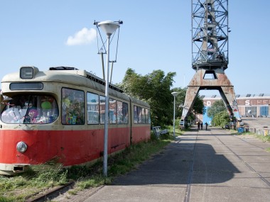
The study of public spaces is configured as a transformation; operations that happen through the usage and actions on pre-existing conditions. This occurs through spontaneous actions and sometimes temporary ones.
For example, In the events that took place after the occupation of Zuccoth Park in New York in September 2011 it was seen that the camps were forming “a common space rather than a single political cause”, “the appropriation of space itself, or in the jargon of the occupants, the liberation of space “.1
“The city is an eminently collective fact that is defined and is in those works
whose nature is essentially collective; and even borning though such works as means to build the city, they soon become a goal; and we do this in their being and their beauty. ” A. Rossi, L’architettura della città.
Possibilities that arise from the opportunity of being in the same space like seeing or hearing other peoples, can be evaluated observing people’s reaction to the presence of other people as observed by Jan Gehl.
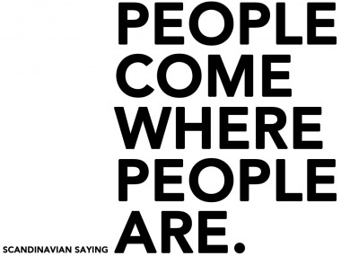
It is generally true that people and human activities attract other people; An old Scandinavian saying tells it all: “people come where people are.”
The social life in public spaces contributes fundamentally to the quality of life of individuals and society. We have a moral responsibility to create physical places that facilitate civic engagement and community interaction.
William Whyte suggests a new bottom-up, instead of top-down, approach to the designing of public spaces. Using his approach, design should start with a thorough understanding of the way people use spaces and the way they would like to use them. Whyte noted that people vote with their feet – they use spaces that are easy to use, that are comfortable. They don’t use the spaces that are not. Through observations and by chatting with people, we can learn a great deal about what people want in public spaces and we can put this knowledge to work creating places that shape liveable communities. We should therefore enter spaces without theoretical or aesthetical biases, and “look hard, with a clean, clear mind, and then look again – and believe what you see.” 4
When outdoor areas are qualitatively poor only strictly necessary activities occur. On the contrary, when outdoors areas are of high quality, necessary activities take place with approximately the same frequency, but they tend to last longer becoming social activities.
“Social activities are all activities that depend on a the presence of others in public spaces. The character of social activities varies, depending on the context in which they occur.”2
Social activities transform the environment on which they are practiced.
The concept of transformation assumes a fundamental role in the usage of space and architecture. Transformation means to act on the environment, modifying the surrounding shapes that characterize it.
Beside the open spaces, architecture organizes also the surrounding spaces. The shape varies in its use in a way that adapts to the circumstances.
Siegfried Giedion wrote about the Renaissance city as the possibility of “re-use of forms” 3. He claims that the new formulation of urban elements characterizes certain historical periods of the city and it does not go through their invention instead. On the contrary, an innovative composition produces a redefinition of the elements and changes with the use of places, without changing their spatial conception.
Is important to give innovative and bright ideas concerning public spaces design in contemporary cities, especially for the spaces without a recognized role in the society. The marginal areas that are elect as new spaces by the users.
Identifying the marginal areas, that become a new part of the social life and have the opportunity to be part of the society and have the opportunity to suggest new scenarios and design of open spaces and architecture: real shared places.
REFERENCES
- Benecit Cluette e Marlisa Wise – Note da un’occupazione, Domus, Gennaio 2012.
- Jan Gehl – Life between buildings, using public space, Van Nosrand Reinhold Company, New York. 1986.
- S. Giedion, Space, time and architecture (1941), tr. it. Spazio, tempo, architettura, Hoepli, Milano 1984
- The Essential William H. Whyte, Albert Lafarge (Editor), Fordham University Press, 2000.
Folding_Peter Eisenman
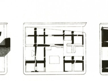
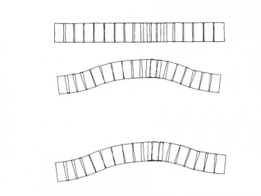
Folding, come dispositivo, strumento di modellazione di una architettura che va dall’ottico al tattile, una operazione ordinaria come una serie di altre operazioni fatte sulle forma, Eisenman conquista la profondità tramite la ribaltamento geometrico, un piano che si ribalta, allora questa operazione preliminare di piegature permette di passare dal piano al tridimensionale: ribaltamento della pianta in alzato, la stessa forma che si ribalta su se stessa e da bidimensionale diventa tridimensionale, da pianta diventa facciata.
Non è un ribaltamento meccanico, ma le permette di conservare tutte le proprietà di transizione, quindi anche l’ordine di idee, un trascinamento della forma, di una sfumatura. Questa è nata dal fatto che Einseman mantiene contemporaneamente tutti gli stadi intermedi che costituiscono l’immagine e le danno una vibrazione che permette l’individuazione dell’involucro. Einseman usa il mezzo informatico, nel suo operato è evidente come lo spostamento del paradigma meccanico sia andato a favore di quello elettronico. La realtà viene definita attraverso i media e la simulazione, privilegia ciò che si vede a ciò che è. L’architetto, lavorando sul modello digitale, su operazioni geometriche e non lavorando solo sulla pianta e sull’alzato, lavora sulle tre dimensioni ma alla base c’è l’idea c’è il folding, del taglio sulla piega. “Piega come generatrice della qualità architettonica”.
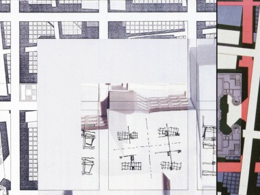
Nelle residenze sociali IBA di Berlino Ovest in cui agli edifici esistenti, Eisenman sovrappone una nuova griglia; In base alla ricerca sul concetto del “palinsesto” (manoscritto pergamenaceo del periodo medievale in cui le sovrapposizioni di scrittura fatte in successione, lasciavano i segni delle precedenti) Eisenman concepisce una città in cui si sovrappongono diverse situazioni urbane, evidenziando griglie e linee di forza. Attraverso operazioni che sono “concettuali” piuttosto che mimetiche.
Sulla base di queste riflessioni, la nuova griglia urbana avrà maggiore evidenza rispetto alla maglia preesistente. Secondo la logica “in between” (verso le esistenze) ripropone al centro le aree residuali; in tal modo ciò che è il “retro” della città diventa il “fronte”, innestando le sue funzioni tra le preesistenze e nuovi oggetti.
Il palazzo per appartamenti, completato nel 1985, sorge in un punto importante della città (Checkpoint Charlie, adiacente al muro tra est e ovest) e completa l’angolo di uno dei grandi isolati della città. In questa occasione l’architetto deve zaccettare la complessità del programma funzionale perché i clienti non sono più intellettuali delle case unifamiliari. Gli appartamenti sono serviti da una scala comune posta nel retro del fabbricato e sono distribuiti da un ballatoio che si ripete nei sette piani. I bagni e le cucine sono lungo il percorso, mentre gli ambienti affacciano all’esterno. Lo schema è funzionale, fornisce le dimensioni e i tagli richiesti, risponde agli standard normativi tedeschi e, attraverso l’andamento mistilineo del perimetro, rende ogni casa speciale. Alla base del progetto questa volta non sono tanto i meccanismi sintattici della architettura di carta, ma appunto l’idea dello sterro: tracce stratificate nei luoghi che, ritrovate quasi archeologicamente, conformano il progetto. Per cui l’edificio usando le parole dell’architetto è come “sollevato” da un terreno archeologico, le masse “sono letteralmente fossili fuoriusciti dal piano orizzontale del terreno”, che lasciano incise nella terra le tracce della loro precedente esistenza (articolazione della pianta) mentre “svolgono il racconto della loro storia nelle facciate.” Queste ultime dunque diventano delle sezioni stratigrafiche, dei pezzi di materia riemersi (e cercano di presentarsi come tali, anche se, naturalmente con i necessari compromessi legati all’uso). Tre costruzioni in rovina e il muro costituiscono condizioni con le quali l’edificio si vuole confrontare rifuggendo dalla logica della nostalgia, del frammento o ancora dell’integrazione o del riempimento. I riferimenti non sono quelli positivi delle presenze, gli edifici costruiti, ma il rilievo delle assenze, ovvero il negativo della griglia urbana e delle sue intersezioni:i vuoti angolari delle piazze, i cui frammenti, a forma di L, danno origine a una struttura planimetrica che funge da matrice, in un processo di scavi, sovrapposizioni, sostituzioni che interessano rispettivamente il suolo e lo sviluppo altimetrico dell’edificio. Tale conformazione infatti non solo condiziona la distribuzione interna (rendendo in questo modo ogni appartamento differente dall’alto), ma si rispecchia nelle facciate, che diventano il supporto verticale per la narrazione del processo attraverso cui l’architetto sceglie di raccontare il luogo e la sua storia.
I vari tracciati usati per modellare il progetto con la tecnica del palinsesto derivano di nuovo dalle planimetrie storiche dell’area non è il collage o il palinsesto il solo motore dell’operazione perché le tracce entrano in relazione con l’organizzazione spaziale.
In questa sperimentazione dello sterro Archeologico e del “tra”, che rappresentano delle effettive acquisizioni portanti del lavoro di Eisenman, e sue personali ricerche, dettate da una curiosità specifiche, come il cubo booleano, il frattale, il Dna. Le teorie sviluppate da Eisenman partono da alcune considerazioi sull’essenza del modello classico, basato sul tetativo di ricostruire dei valori come Significato, Verità, ed Eternità. Poiché lui stesso si è detto promotore del completamento dell’architettura moderna, in quanto non aveva raggiunto piena maturazione. Questi valori devono essere interpretati oggi come delle Fiction. Solo con questi presupposti possono essere proposte alternative per l’origine del processo compositivo. Strumenti per modificare queste origini artificiali, intesi come punti arbitrari nell’approccio compositivo, sono identificati da Eisenman nello Scaling, nel Folding e nel Graft.
Le caratteristiche dello scaling (spostamento di scala) sono la ricorsività, l’auto similarità e la discontinuità. La ricorsività può essere spiegata attraverso l’analisi delle serie matematiche: un quadrato diviso i quattro quadrati, ciascuno a sua volta diviso in quattro è un esempio di ricorsività; ma è anche un esempio di auto identità che si ritrova nello spazio architettonico classico.
Il secondo aspetto dello spostamento di scala è l’auto similarità che si contrappone alla auto identità poiché nella prima viene cancellata la nozione di origine e di valore. Quindi l’origine di un processo compositivo può essere usato qualsiasi numero di forme e di strutture, per cui una struttura ricorsiva auto similare non deve iniziare con la scala dell’abitazione umana. Un’altro aspetto dello scaling si riferisce all’idea di discontinuità: come il problema della scala, il problema di presenza è fondamentale riguardo la questione dell’antropocentrismo. I processi e le geometrie tradizionali dell’architettura sono necessariamente continui perché sono fondamentalmente dei processi e delle geometrie di presenza.
Il “Graft” (innesto) è un altro esempio di un processo compositivo in cui l’innesto è inteso come l’inserzione genetica di un corpo estraneo dentro un corpo ospite per attivare un risultato nuovo. In opposizione ad un collage o montaggio, che vive all’interno di un contesto ed allude ad un’origine, un innesto è un luogo inventato che on ha tanto le caratteristiche dell’oggetto, quanto quelle del processo. “Un innesto non è in se stesso genericamente arbitrario, la sua arbitrarietà è nella sua libertà da un sistema di valori. E’ arbitrario in quanto fornisce una chiave di lettura che non porta alcun valore esterno al processo. L’innesto non è un risultato necessariamente raggiungibile, ma semplicemente un luogo che contiene la “motivazione” per l’azione, cioè l’inizio di un processo.”.
Il folding si propone come un’operazione geometrica di modellazione dell’oggetto che appare effettivamente come attraversato da scosse e piegature. “Eisenman scopre una tecnica di progetto di grandissimo fascino perché dà una risposta finalmente innovativa ad un vecchio problema della nuova architettura: il movimento”.
La presenza del movimento come tecnica non più tanto di percezione non più statica (dal punto di vista privilegiato del cono prospettico rinascimentale) o quello di esplorazione dinamica della composizione spaziale ma proprio come tecnica di progetto.
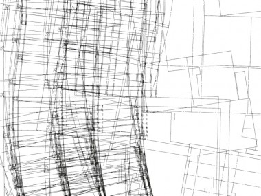
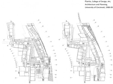
Il movimento non viene “interpretato” ma diventa l’ispirazione “concettuale” e allo stesso la “tecnica” con cui organizzare un nuovissimo modo di progettare. L’origine è nel futurista italiano Giacomo Balla, la Donna con il cagnolino (1912) e l’immagine universalmente nota della donna che scende le scale di Marcel Duchamp (1916): Una serie di sovrapposizioni della figura come in un fotogramma scattato con un tempo troppo lungo in cui i singoli movimenti sono sovrapposti (in Balla, vi torneremo, sono anche “sfocati”). È una tecnica di straordinaria interesse rimasta muta per ottanta anni in architettura. Sino ad Eisenman. Che, ed è molto strano per lui che ama teorizzare, proprio questa volta non rivendica l’importante paternità: l’aver trasmigrato per primo questa tecnica dall’arte figurativa a quanto di più solido esiste. Eisenman configura spazi che riproducono i momenti di una vibrazione o di un’oscillazione. Il tema del movimento e del dinamismo aveva raggiunto l’apice di espressione nelle opere visionarie e surreali dei Futuristi: da un lato Sant’Elia e i Neoplastici avevano intrapreso la strada del tema eroicamente dinamico ma carente nella modalità di rappresentazione, dall’altro Balla era riuscito a caratterizzare dinamicamente le sue opere in maniera genetica. Eisenman fa propria questa tecnica nel progetto per la facoltà di Architettura di Cincinnati, in cui si ha l’integrazione della tecnica dell’oscillazione con la tecnica dell’in-between. Nel College of Design, Art, Architecture and Planning, University of Cincinnati al corpo preesistente viene fatto vibrare un nuovo corpo, che viene duplicato attraverso le sue linee forza e le sue giaciture che diventano spazi terrazzati, costruiti, vegetali. Le linee che determinano la vibrazione non hanno tutte la stessa funzione ma hanno la stessa genesi, appartengono allo stesso palinsesto. Alla vibrazione del vecchio edificio viene sommata
l’oscillazione di un nuovo edificio e le due costruzioni vengono legate da una galleria.
Il progetto, doveva rispondere a una doppia esigenza: riorganizzare gli spazi della facoltà esistente e poi edificare altre attrezzature (biblioteche, sale mostre, teatri studi uffici) che ne raddoppiasse quasi la superfici utile. La prima idea è relativamente semplice. Alla struttura dell’edificio esistente, che si muove funzionalisticamente a zig-zag sul terreno, viene aggiunta una struttura ad andamento ondulato che contiene le nuove attrezzature. Ma l’idea geniale consiste nell’applicare la tecnica del Folding e del Blurring simultaneamente al nuovo fabbricato e a quello preesistente. Entrambe le geometrie di base vengono duplicate e ruotate con la tecnica del Cagnolino di Balla. Nasce un moto ondulatorio doppio che si piega e dispiega: uno più geometrico (quello del vecchio edificio) l’altro più fluente determinato dalla curva in cui si organizzano le nuove funzioni. Il risultato è di sconvolgente novità e di grande interesse. Perché queste due geometrie, giocando con incastri sottrazione e intersezioni reciproche dettano la conformazione dei nuovi spazi, dei volumi delle stesse geometrie terrazzate o vegetali che si proiettano nel sito. “Il progetto fa vibrare e fremere le forme una sull’altra in un incessante moto ondulatorio”. I movimenti di traslazione e ondulazione delle due geometrie non solo si ripercuotono all’esterno, ma soprattutto all’interno. L’incrocio infatti è qui di volumi, plasmati differentemente e con libertà attraverso le tre tecniche booleane. Sono spazi assolutamente sconvolgenti. Vi gioca la luce dall’alto di lato in fondo, i volumi assumono varie inclinate, i pilastri ritmano senza alcuna rigidità preconcetta i cavi. Sono spazi che danno effettivamente forma ad un pensare “concettualmente” all’architettura con una forza e un livello di complessità finalmente adeguato ai mezzi intellettuali che questi ultimi anni stanno elaborando.
La base concettuale che Eisenman rielabora per la realizzazione e la concettualizzazione della piega è il saggio di Deleuze, che esplora la cultura barocca, dall’architettura alla matematica, dalla pittura alla musica, attraverso la metafora del “movimento” e della “piega”.
Deleuze scrive riferendosi alla filosofia di Leibniz, filosofia barocca per eccellenza, perché in esso tutto si dispiega, si ripiega.
La fisica matematica barocca è stata “incentrata sull’idea di curvatura” (Huyghens), questa curvatura all’infinito basandosi su tre nozioni fondamentali: la fluidità della materia, l’elasticità dei corpi e il meccanismo della molla. La piegatura, per Deleuze , non è il contrario della piega, ma segue la piega fino al formarsi di un’altra piega “particelle volte in pieghe […] che una tensione contraria sottopone a sempre nuovi mutamenti”. Piegare significa tendere- distendere, una piega organica deriva sempre da un’altra piega, ma in ogni piega è insito un Zwiefalt, una duplicità che non si esprime tramite una piega in due, perché “ogni piega lo è già necessariamente, ma è una piega a due, o tra due, nel senso in cui è la differenza stessa, qui, a differenziarsi”. L’elemento genetico della piega è la curvatura variabile: “l’inflessione” enucleata da Klee, come elemento genetico tramite il punto che , messo in movimento da una forza esterna, percorre una inflessione. È il punto stesso di inflessione, la dove la tangente attraversa la curva: “punto – piega”.
L’inflessione genera la concavità, definendo spazi interni e spazi esterni. Se l’inflessione è generata dai punti di inflessione che a loro volta diventano interni ed esterni alla concavità viene così Viene introdotto il punto di vista: variazione dell’inflessione colta dal soggetto nel punto, punto di vista come nuovo modello ottico della percezione.
Ma il punto fisico è anche quello che percorre l’inflessione: “l’inflessione definisce la piega, ma l’inclusione definisce a sua volta l’anima o il soggetto, vale a dire ciò che avviluppa la piega, la sua causa finale e il suo atto compiuto”
Nel Barocco c’è l’invenzione infinita della piega, dal basso al soffitto e verso l’infinito, separando l’interno dall’esterno. C’è dispiego della piega, non cancellazione mal’estensione del suo atto e del suo manifestarsi.
Eisenman ricerca un paradigma nella piega, un modello, e mostra come è possibile procedere da una idea astratta verso un concetto nient’affatto astratto, per mostrare come la dinamica generativa di ogni suo progetto può essere descritta o, se occorre ricostruita, in ogni minimo dettaglio. L’esito progettuale richiama gli insegnamenti del matematico Colin Rowe e degli insegnamenti che trae dal saggio di Deluze, definendo attraverso la piega l’uso di un metodo e l’applicazione di una procedura come “arte del pensare” riportano alla memoria anche le sperimentazioni geometriche dettate dal Barocco, mostrando un linguaggio geometrico- matematico in grado di guidare l’intenzionalità progettuale.
Nicola Petaccia
Bibliografia
– Peter Eisenman, Re:working Eisenman, Academy Editions, 1993
– Gilles Deleuze, La piega: Leibniz e il Barocco, Enaudi, 2004
– Daniela Brogi, Peter Eisenman, Motta architettura, 2007
– Antonio Saggio, Peter Eisenman
– Trivellazioni nel futuro,Universale di architettura,1996
– Matthew Krissel, Philosophy of Materials and Structures
– the architecture of space and the fold, 2004
– www.eisenmanarchitects.com
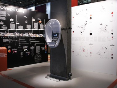
OLYMPIC CITIES
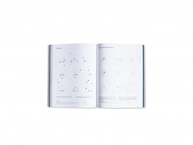
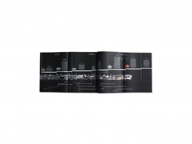
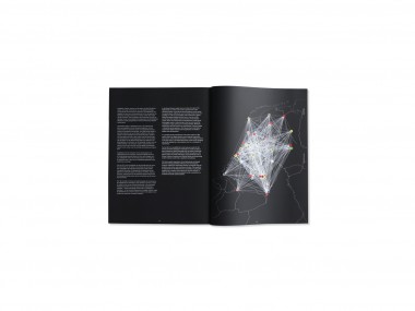
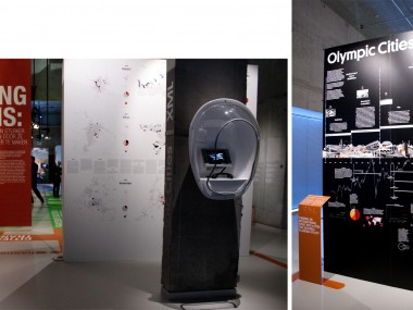
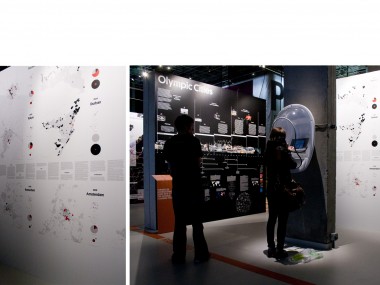
With the Amsterdam based architecture office XML I worked on a comparative study on Olympic candidatures in the fall of 2011, as commissioned by the Ministry of Infrastructure and the Environment and Atelier Making Projects. The study, which compares the various bids by Madrid, Istanbul, Doha and Tokyo for the 2020 Games and the South African bid for the 2024 Games, discusses three themes, Cultural Pride & Marketing, Economy, Infrastructure & Design and Power Geographies, and clarifies the narratives that cities use in their bids, the various spatial concepts for the Games, and the power geography surrounding the bids. In this way, XML provides the first international perspective for the development of a Dutch bid for the Games. In the project XML collaborated with local correspondents in each of the researched cities: Gillian Benjamin (South Africa), Mirai Morita (Tokyo), Selva Gürdoğan & Gregers Tang Thomsen (Istanbul), Todd Reisz (Doha) and Gianpiero Venturini (Madrid).
The study established that existing bids, including the current Dutch proposals, are based on the paradigm of the Olympic Games as a mega-event. As XML shows, however, the Olympics are not a neutral autonomous, immutables event. Olympic history points to cycles of twenty years, in which the Games are closely linked to political, economic and social developments. Each period has a specific paradigm that defines the meaning of the Games and their significance for the times. The study also shows that it is highly probable that the 2028 Games will coincide with the start of a new cycle. Under the heading ‘The Netherlands as Game Changer,’ XML proposes, therefore, that a Dutch bid should not focus on what the Games mean today, but should incorporate long-term global developments and their future ramifications for the Netherlands.
In line with these conclusions, XML has developed three spatial models that show how the Netherlands can host the 2028 Games by effectively responding to these long-term global developments. In the ‘Deltapolis’ model, the two Randstad areas, North Wing and South Wing, are integrated into a single, internationally competitive urban region: the Deltapolis. The ‘Virtual Games’ model is a response to technological developments and the rapid digitalization of society. In ‘Global Games,’ finally, XML proposes a new organizational model for the Games that reinforces international networks and exchange between cities. These visions for the Games, each with a specific narrative, are atuned to long-term global trends (instead of the limitations of current IOC requisites) and show how the Dutch bid can become an effective response to these trends. The visions may be viewed as a design postscript to the comparative study of Olympic candidatures.
XML Urbanim Research Architecture
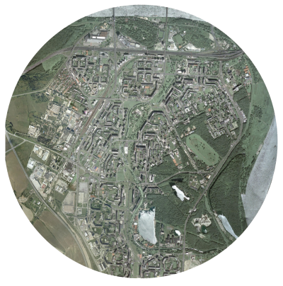
Petržalka case study.
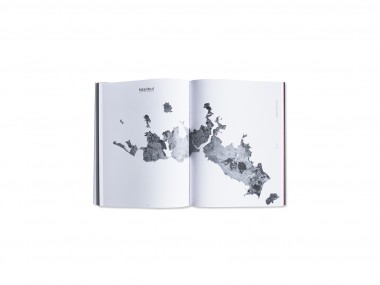
Bratislava is the cultural and economical capital of Slovakia. The city is crossed by the river Danube, one of the most important European rivers. The end of World War I in November 1918 brought major changes to the map of Europe. The Austro- Hungarian Empire dissolved and the Czechoslovak Republic was created on October 1918 The Slovak part of Czechoslovakia industrialized rapidly in the 1950s and 1960s, villagers migrated in droves to the cities. The cheapest and quickest way to accommodate them was to construct tower- ing blocks of flats, clumped together densely so that essential services could be delivered to them as efficiently as possible. Large residential areas consisting of high-rise prefabricated panel buildings, such as those in the Petržalka borough, were built. At the territory of today’s Petržalka, city district of the Bratislava, there was located a ford of international importance already in Middle Ages. The beginning of settlements in this territory dates back to 13th cen- tury. According to the oldest description of settlement of today’s Petržalka, there was established village Flezyndorf. In 1866 there lived 594 inhabitants in 103 houses in Petržalka. Fires caused great damage which consequences significantly affected all district inhabitants. Petržalka was indefinitely connected to Bratislava through the first railway bridge, constructed in 1891. In 1946 Petržalka became the part of Great Bratislava. Since 1973 when the decision of liquidating old Petržalka was made, current appearance of this hous- ing estate has been formed. From 1950 and 1965 the number of inhabitants increased from 190.000 to 271.000. An intense production of apartments and residential buildings for all the inhabitants increased slowly in the left side of the city. The requirements of the project were defined in a way to predict a raise of the population up to 350.00 inhabitants. The district of Petržalka is linked to the city centre by five bridges: two for the highway, one old pedestrian bridge and two bridges for Danube car-crossing. The analysis of infrastructures stems from the hierar- chy of the streets serving the area, that is the system linking Petržalka to the rest of the city and to the close Austria, especially Vienna. The area of Petržalka is characterized by several building typologies, different for the plan, the array of the buildings, the height. In all the different parts com- posing Petržalka the buildings have an introvert array, and face the courtyards where the schools lie. Petržalka is full of services like schools, post of- fices and municipalities. Conversely, all other kind of services should have placed in the area according to the original project, but they have never been realized due to the lack of financial resources. The most relevant problem of this area is the highway, which stands as a barrier separating Petržalka from the park and stadium area. The analysis on the area proved the need of creating a mix of services in the central part, in a well planned system which could link the different parts of the district, nowadays completely patchy and scattered.
For the development of the strategy I focused on the infrastructural aspect, by identifying the most impor- tant infrastructural axes and defining their function and influence on the surrounding territory.
The central part, which during the creation of Petržalka was designed to host services and func- tions missing in the district (and then never built due to the lack of financial resources), currently displays some poles at both the city scale (e.g. the Stadium) and (mostly) the district scale. The missing axis, which has a great landscape potential thanks to the channel and to the big green central space, today is left abandoned. In my intervention strategy I propose to revaluate this potential and re-establish the original function of this axis, by adding the new functions and missing public spaces, concurrently increasing the value of the surrounding landscape. In order to give value to the urban green in the area I consider the hypothesis of reconverting all the green space standing in the central part into a multi purpose green axis, where landscape, buildings and infrastructures interact naturally in order to provide higher breadth to the district and to tackle its massive constructions. With specific reference to the open space, our strategy has the mission to differentiate it into squares, green areas with facilities, green for sport, naturalistic greenery, picnic areas, boulevards, in order to create a mix of possible uses. Mobility plays a fundamental role, with the introduc- tion of a fast tram line serving as the structural axis for the intervention. The buildings that are about to be built represent a filling of the current public space rather than a presence facing the surrounding con- text. My intent is also to tackle the area identity issue, as the inhabitants have difficulties to distinguish the different part of the area, or to find their own house. Our strategy points at differentiating the area into three parts, characterized by the presence of the fol- lowing functional themes: In order to identify a reference grid for the articulation of the public space, I observed how over time a lot of spontaneous pedestrians routes randomly cross- ing the channel area came to life, beyond the spaces carefully and strictly designed in the socialist era. These routes, mostly never ending and traced in the existing green, define a patchy track which coasts all the design area. In order to articulate the public space, taking into consideration the visual axes as a mean to link the different parts of the area, I started from these routes with the idea of creating a more free fruition of the public space. This also results from the observation of how the inhabitants of Petržalka spontaneously love to walk along and near the chan- nel to reach their destinations. In order to recreate this usage and habit, I considered a hierarchy of secondary lines which could lay on the previously defined grid of primary visual axes. In this project I consequently tried to grant a walkability which could offer a multiplicity of alternatives, with either naturalistic routes and paths or open spaces nearby and along the channel defined by the track of this grid. This in turn creates a landscape system also integrated with the buildings disposition and with the functions we imagined to place in the area. With this intervention of re-qualification I would like to re-establish the human scale in Petržalka, bring- ing back its origins, when it was a small town and its park was a place of interest and attraction for all the city, where took place fairies and events of European resonance. In addition, the agricultural theme in the area of Petržalka brings many perspectives, both in the re- covery of the identity of the district, with the creation of urban vegetable gardens and in the functional aspect interacting with the near agricultural areas and the creation of a farmer market which could bring back again the attention on the local products. The idea of giving new value to the public space propos- ing different thematic poles along the channel (commercial, cultural, sport, agricultural), comes from the willingness to differentiate the several parts of the area and the public space above all, which nowadays has a big lack of characterization and attractions. The area of Petržalka, like all the other urban con- temporary and precedent experiments, proved how the concept of public space spread in those years failed miserably, showing how it was inadequate and not adapt to the inhabitants’ needs, changing so fastly and needing flexibility. In the original project the idea of public space was referred only to the buildings courtyards, and therefore only playgrounds and little sport fields were designed in order to answer to the basic inhabitants’ needs; no any other public space common to all Petržalka has ever been thought and designed. In the course of the time has become evident how the inhabitants need to live their district beyond the basic functions that it can offer, and how the free time is a valuable resource to be preserved in the design of adequate public spaces, outdoor and indoor. My strategy propose to re-establish an equity between the inhabitants and their public space, and to allow them to use a precious resource which today they are not able to enjoy. The quality arises around the people and can be generated by a scale reduction which could foster a new urban identity.
Nicola Petaccia

