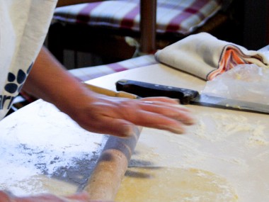
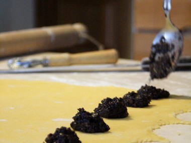
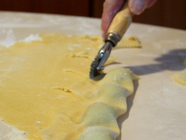
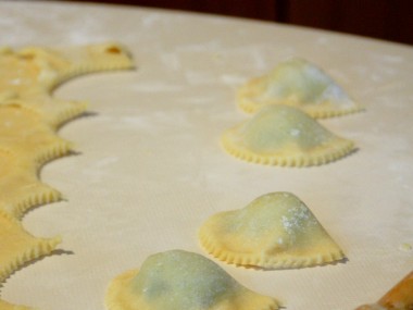
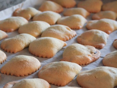
This holidays I have been following my mom while she was making the typical Christmas Foods. As every year she started with some days in advance to make the typical Christmas cookies. Yesterday she was making the Caggiunitt’, also known as Calgionetti. They are a typical cookies in Abruzzo region, traditionally made during Christmas time.
Calgionetti are basically a stuffed pastry in the shape of ravioli (square) or tortelli (half circle) filled with hazelnuts, chocolate, cinnamon, cooked Must (grape juice) and orange peel.
The cookies are often fried but, as my mom do, they can also be baked for the more health-conscious.
The pastry dough what my mom make is a Shortcrust pastry made from water, flour, butter, yeast, sugar and cinnamon to the filling.
The only think is just that, when they are pulled out of the oven the smell of cinnamon and Must expands to the whole house: Suddenly is Christmas and… they are truly tasty!
All posts by NP
106 PostsPistachios Nougat
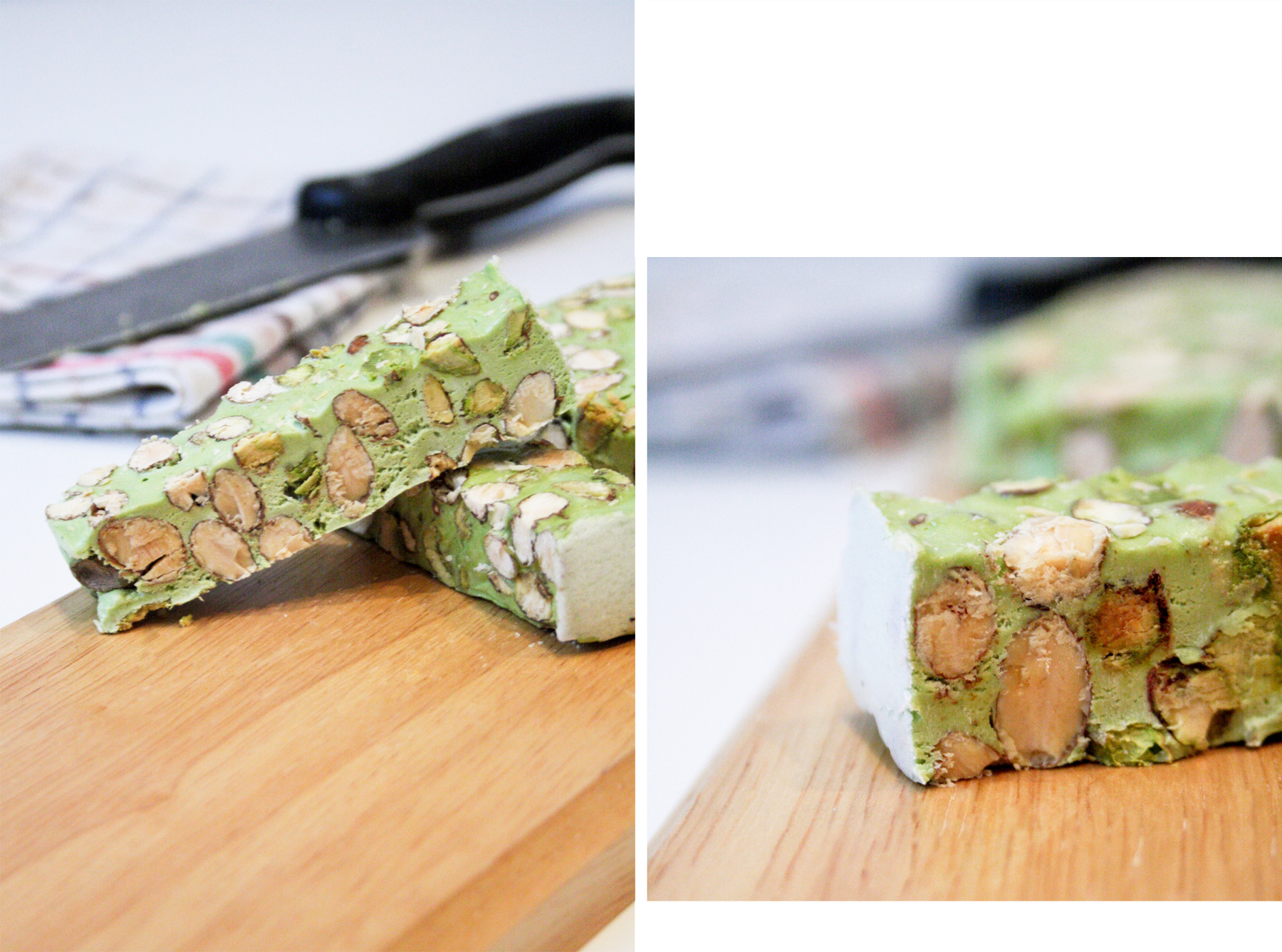
It is almost Christmas time and also in Milan it is the time of the “Oh Bej! Oh Bej!” that is a traditional fair. It is held from 7 December (day of the patron of Milan Saint Ambrose) until the following Sunday.
I have been walking through this colorful and picturesque market and with a lot of pleasure I found out an interesting Pistachio Nougat.
Maybe it is nothing new, nothing special but those who know me, knows that I like pistachios (especially in ice cream) and moreover I love green things… so how could I resit to this green “Torrone ai pistacchi” pistachios nougat!?
So I couldn’t resist and I bought this very traditional food of Christmas season in Italy and I enjoyed it!
*Nougat is a variety of similar traditional confectioneries made with sugar and/or honey, roasted nuts (almonds, walnuts, pistachios, hazelnuts, and recently macadamia nuts are common), whipped egg whites, and sometimes chopped candied fruit. The consistency of nougat can range from soft and chewy to hard and crunchy depending on its composition, and it is used in a variety of candy bars and chocolates. The word nougat comes from Occitan pan nogat, from nux gatum, which means nutbread. [Mention Wikipedia*]
Panino con la Porchetta
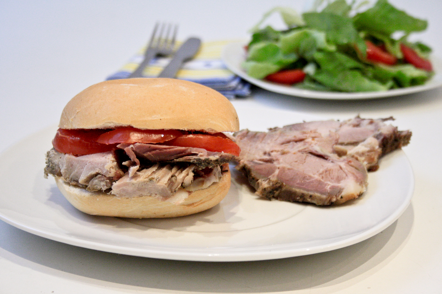
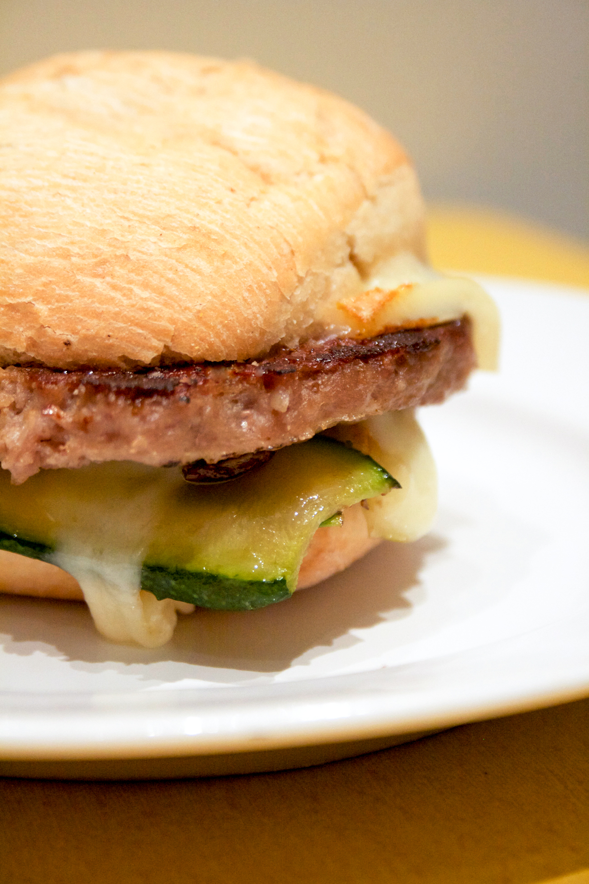
Today I went to the market and it has end pretty well. After some years I have been living in Milan I finally found one of my favorite food: La Porchetta.
Despite I had different plan for my lunch I couldn’t resist ad I bought it!
Every time I go back in my hometown that is one of the first food I always ask to my mom! This roasted meat is originated in central Italy and it so also really tipical in my Region, the Abruzzi.
The body of the pig is gutted, deboned, arranged carefully with layers of stuffing, meat, fat, and skin, then rolled, spitted, and roasted, traditionally over wood. Porchetta is usually heavily salted in addition to being stuffed with garlic, rosemary, fennel, or other herbs, often wild.
If u can wait, after hours of cooking you can buy and relish a really tasty meat and made a nice sandwich as I did.
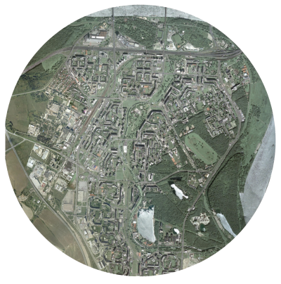
Petržalka case study.
Bratislava is the cultural and economical capital of Slovakia. The city is crossed by the river Danube, one of the most important European rivers. The end of World War I in November 1918 brought major changes to the map of Europe. The Austro- Hungarian Empire dissolved and the Czechoslovak Republic was created on October 1918 The Slovak part of Czechoslovakia industrialized rapidly in the 1950s and 1960s, villagers migrated in droves to the cities. The cheapest and quickest way to accommodate them was to construct tower- ing blocks of flats, clumped together densely so that essential services could be delivered to them as efficiently as possible. Large residential areas consisting of high-rise prefabricated panel buildings, such as those in the Petržalka borough, were built. At the territory of today’s Petržalka, city district of the Bratislava, there was located a ford of international importance already in Middle Ages. The beginning of settlements in this territory dates back to 13th cen- tury. According to the oldest description of settlement of today’s Petržalka, there was established village Flezyndorf. In 1866 there lived 594 inhabitants in 103 houses in Petržalka. Fires caused great damage which consequences significantly affected all district inhabitants. Petržalka was indefinitely connected to Bratislava through the first railway bridge, constructed in 1891. In 1946 Petržalka became the part of Great Bratislava. Since 1973 when the decision of liquidating old Petržalka was made, current appearance of this hous- ing estate has been formed. From 1950 and 1965 the number of inhabitants increased from 190.000 to 271.000. An intense production of apartments and residential buildings for all the inhabitants increased slowly in the left side of the city. The requirements of the project were defined in a way to predict a raise of the population up to 350.00 inhabitants. The district of Petržalka is linked to the city centre by five bridges: two for the highway, one old pedestrian bridge and two bridges for Danube car-crossing. The analysis of infrastructures stems from the hierar- chy of the streets serving the area, that is the system linking Petržalka to the rest of the city and to the close Austria, especially Vienna. The area of Petržalka is characterized by several building typologies, different for the plan, the array of the buildings, the height. In all the different parts com- posing Petržalka the buildings have an introvert array, and face the courtyards where the schools lie. Petržalka is full of services like schools, post of- fices and municipalities. Conversely, all other kind of services should have placed in the area according to the original project, but they have never been realized due to the lack of financial resources. The most relevant problem of this area is the highway, which stands as a barrier separating Petržalka from the park and stadium area. The analysis on the area proved the need of creating a mix of services in the central part, in a well planned system which could link the different parts of the district, nowadays completely patchy and scattered.
For the development of the strategy I focused on the infrastructural aspect, by identifying the most impor- tant infrastructural axes and defining their function and influence on the surrounding territory.
The central part, which during the creation of Petržalka was designed to host services and func- tions missing in the district (and then never built due to the lack of financial resources), currently displays some poles at both the city scale (e.g. the Stadium) and (mostly) the district scale. The missing axis, which has a great landscape potential thanks to the channel and to the big green central space, today is left abandoned. In my intervention strategy I propose to revaluate this potential and re-establish the original function of this axis, by adding the new functions and missing public spaces, concurrently increasing the value of the surrounding landscape. In order to give value to the urban green in the area I consider the hypothesis of reconverting all the green space standing in the central part into a multi purpose green axis, where landscape, buildings and infrastructures interact naturally in order to provide higher breadth to the district and to tackle its massive constructions. With specific reference to the open space, our strategy has the mission to differentiate it into squares, green areas with facilities, green for sport, naturalistic greenery, picnic areas, boulevards, in order to create a mix of possible uses. Mobility plays a fundamental role, with the introduc- tion of a fast tram line serving as the structural axis for the intervention. The buildings that are about to be built represent a filling of the current public space rather than a presence facing the surrounding con- text. My intent is also to tackle the area identity issue, as the inhabitants have difficulties to distinguish the different part of the area, or to find their own house. Our strategy points at differentiating the area into three parts, characterized by the presence of the fol- lowing functional themes: In order to identify a reference grid for the articulation of the public space, I observed how over time a lot of spontaneous pedestrians routes randomly cross- ing the channel area came to life, beyond the spaces carefully and strictly designed in the socialist era. These routes, mostly never ending and traced in the existing green, define a patchy track which coasts all the design area. In order to articulate the public space, taking into consideration the visual axes as a mean to link the different parts of the area, I started from these routes with the idea of creating a more free fruition of the public space. This also results from the observation of how the inhabitants of Petržalka spontaneously love to walk along and near the chan- nel to reach their destinations. In order to recreate this usage and habit, I considered a hierarchy of secondary lines which could lay on the previously defined grid of primary visual axes. In this project I consequently tried to grant a walkability which could offer a multiplicity of alternatives, with either naturalistic routes and paths or open spaces nearby and along the channel defined by the track of this grid. This in turn creates a landscape system also integrated with the buildings disposition and with the functions we imagined to place in the area. With this intervention of re-qualification I would like to re-establish the human scale in Petržalka, bring- ing back its origins, when it was a small town and its park was a place of interest and attraction for all the city, where took place fairies and events of European resonance. In addition, the agricultural theme in the area of Petržalka brings many perspectives, both in the re- covery of the identity of the district, with the creation of urban vegetable gardens and in the functional aspect interacting with the near agricultural areas and the creation of a farmer market which could bring back again the attention on the local products. The idea of giving new value to the public space propos- ing different thematic poles along the channel (commercial, cultural, sport, agricultural), comes from the willingness to differentiate the several parts of the area and the public space above all, which nowadays has a big lack of characterization and attractions. The area of Petržalka, like all the other urban con- temporary and precedent experiments, proved how the concept of public space spread in those years failed miserably, showing how it was inadequate and not adapt to the inhabitants’ needs, changing so fastly and needing flexibility. In the original project the idea of public space was referred only to the buildings courtyards, and therefore only playgrounds and little sport fields were designed in order to answer to the basic inhabitants’ needs; no any other public space common to all Petržalka has ever been thought and designed. In the course of the time has become evident how the inhabitants need to live their district beyond the basic functions that it can offer, and how the free time is a valuable resource to be preserved in the design of adequate public spaces, outdoor and indoor. My strategy propose to re-establish an equity between the inhabitants and their public space, and to allow them to use a precious resource which today they are not able to enjoy. The quality arises around the people and can be generated by a scale reduction which could foster a new urban identity.
Nicola Petaccia


